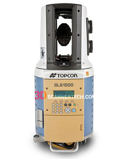
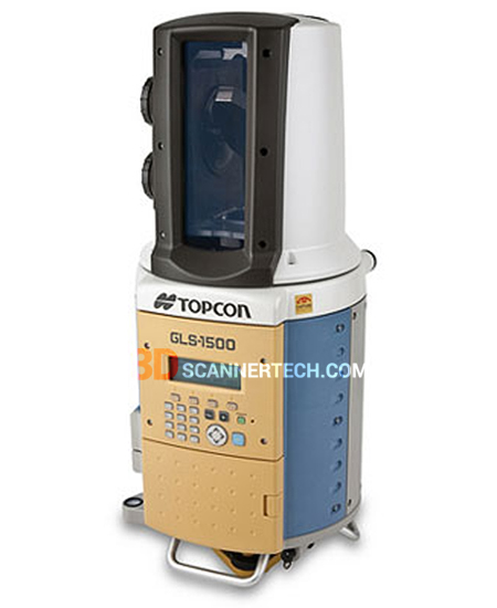
Topcon GLS-1500
Topcon GLS-1500 Sale, ScanMaster Office Software installed.
Topcon 3D Laser Scanners
Topcon
Topcon GLS-1500 Sale, ScanMaster Office Software installed.
Topcon GLS 1500 Features:
- Long-Range 500m
- High-speed Scan with 30,000 points/second
- Topcon Precise Scan Technology provides Clean,
- Ultra-Low-Noise Scan Data
- 4mm Distance Accuracy at 150m
- All-in-one Solution for Superior Mobility
- Quick Sighting with Jog Dial ControlsBuilt-in Digital Camera
- ScanMaster Software for Powerful Data Processing
- Presents Photo-realistic Point Clouds
- Remote Control via Wireless LAN
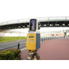
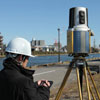
500m Long-Range scanning and High-Precision 3D data
 Enable to select from 2 range mode, maximum 500m range mode is prepared in addition to existing 330m high-accuracy scanning.
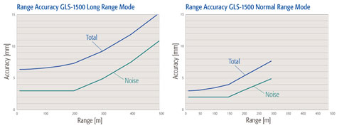
Ultra-Low-Noise Data
 The most crucial technological challenge in scanning technology is how to minimize the noise included in the captured data. Topcon Precise Scan Technology achieves dramatic noise reduction that makes it possible to present the finest texture of scanned objects.
Topcon Precise Scan Technology
 Distance accuracy: 4mm@150m
Angle accuracy (H&V): 6 arc-seconds
Topcon Precise Scan Technology maximizes the accuracy and the data quality by minimizing noise and measurement deviation.
Increased Scanning Speed! 30,000 points per second
 GLS-1500 incorporates newly developed laser diode that constantly emits laser beam at 30,000 times per second, 10 times faster than the previous model. Higher-density point clouds can be captured in a shorter time, increasing productivity and the quality of laser scanning.
Various Scanning Mode
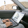
ScanMaster controls the GLS-1500 scanner unit via wireless LAN. Scan area can be easily specified on video or picture images on a computer screen.
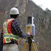
All-in-One, stand-alone scanner unit provides easy operation and superior portability, similar to the total stations. GLS-1500L has palm-of-your-hand operations via compact tablet PC
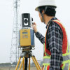
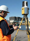
Easy Operation and Superior Portability
GLS-1500 can be operated in a similar manner to total stations. A tripod is the only external device needed.
Dual-axis Tilt Sensor

GLS-1500 automatically compensates the instrument tilt within ±6' using a built-in dual-axis tilt sensor. This capability increases accuracy of station setting using instrument point and backsight data.
Station Setting with Backsight Coordinates
In addition to orientation using geo-referenced tie-point targets, GLS-1500 can determine the coordinate system using instrument point and backsight data, thanks to the high accuracies in distance, angles and tilt compensation. This capability increases work efficiency by minimizing number of targets needed for orientation.
ScanMaster Field Free Controller Software
 ScanMaster Field”, a free tablet PC software, controls Topcon GLS series laser scanners. Operations are made simple with a compact tablet PC in the palm of your hand.
Rich Functions, Easy Operation
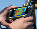
ScanMaster Field allows you to use live video images when you specify scan area, check scanning progress, and perform target scan. Tablet PC can be connected with the GLS scanner using a USB cable or Wireless LAN.
Tilting Base (optional)
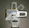
Tilts the GLS-1500 unit to scan upper and lower portions of tunnels, buildings and other large structures. Maximum ±90° tilting range with 15° steps.