Used Geoslam ZEB HORIZON 3D UAV mount
Geoslam ZEB Horizon 3D mobile scanner with UAV mount, almost new! 1 year manufacturer warranty! Low Hours! UAV mount included! Hub & Draw Start license

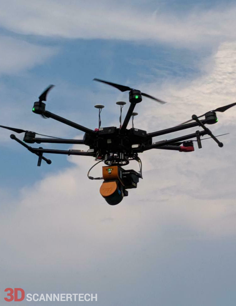
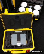
Used Geoslam ZEB Horizon 3D mobile scanner with UAV mount, almost new, 1 Year manufacturer warranty, low hours, Hub & Draw Start license, UAV mount (The Drone is displayed for visual, not included in this sale).
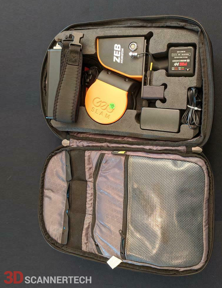
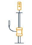
GeoSLAM ZEB-HORIZON 3D mobile scanner sale includes:
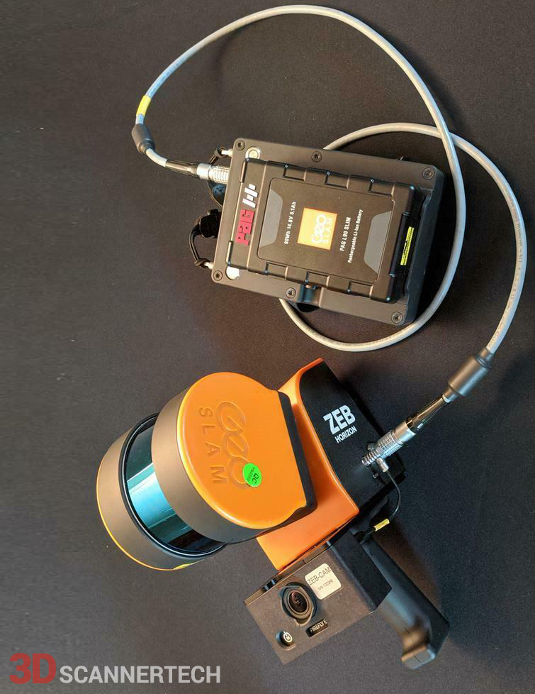
- ZEB-HORIZON scanner
- ZEB-HORIZON HDD datalogger (CPU)
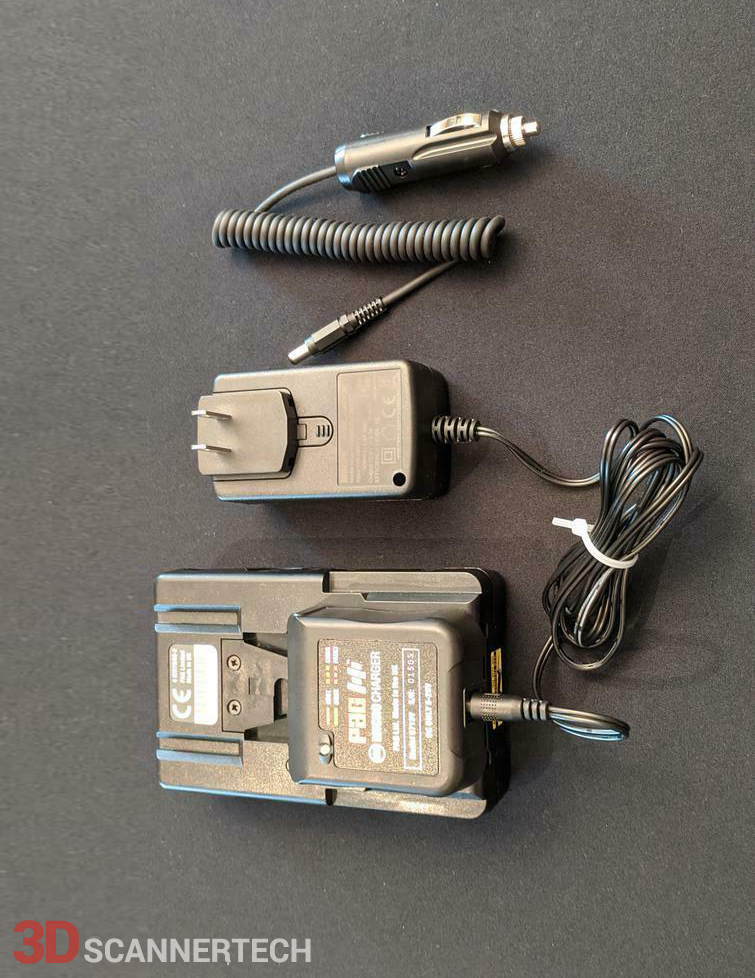
- ZEB-HORIZON Cables Set
- ZEB-HORIZON Battery pack
- GeoSLAM Hub & Draw Start license
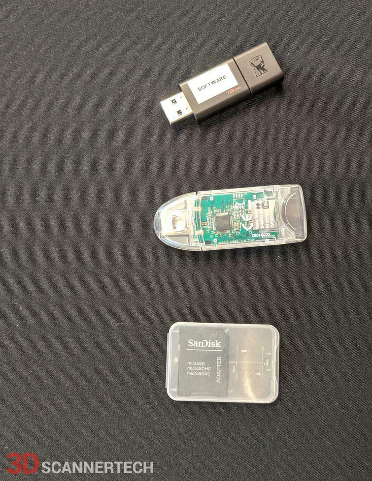
- USB3 memory stick containing Installation & User Guide
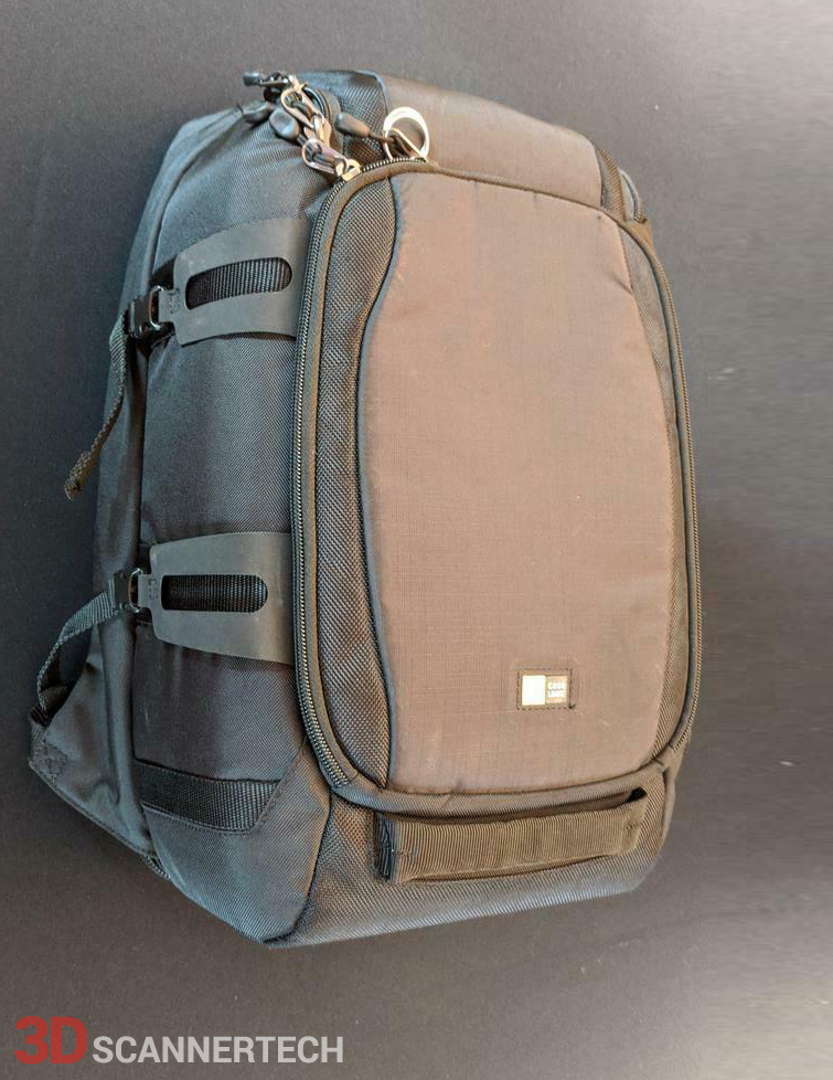
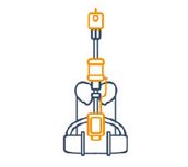
- ZEB-HORIZON Backpack
- Additional ZEB-CAM-HORIZON
- 1 year extended hardware warranty
- 1 year extended GeoSLAM Hub & Draw Start software support
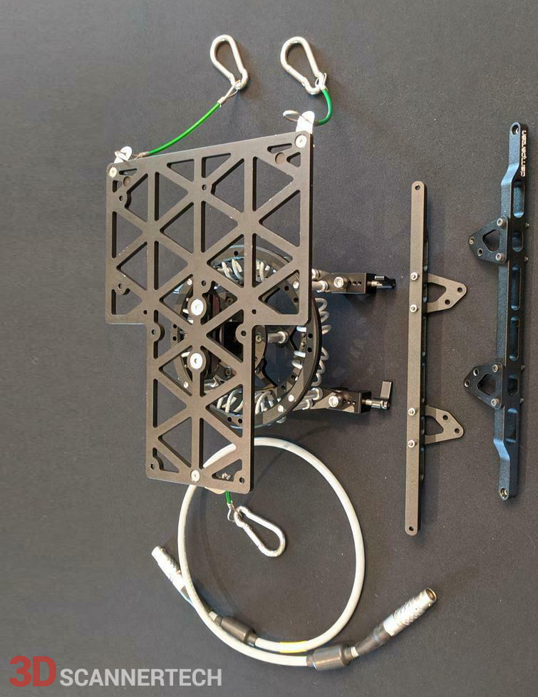
- UAV mount
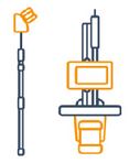
ZEB-HORIZON with UAV Mount | The ultimate mobile mapping solution
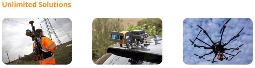
Meet the newest member of the GeoSLAM family - the ZEB-HORIZON 3D mobile scanner. With a range of 100m, the ZEB-HORIZON is great for outdoor use, yet its lightweight and compact design also makes it perfect for indoor surveys. With powerful SLAM technology at its heart, the ZEB-HORIZON can be used in remote areas with poor GPS - such as underground or in forest environments. The complete Solution comes in a backpack for simple transportation and ease of use. Elevate the ZEB-HORIZON with an extendable pole to increase scanner range, or to access hard-to reach spaces (such as ceiling voids). Attach the ZEB-HORIZON to the GeoSLAM Cradle to lower into inaccessible areas (such as manholes). Mount the ZEB-HORIZON to a drone and take to the skies for complete coverage of all features.
Specifications and Features
Its lightweight and compact design also make it perfect for indoor surveys. If you want flexibility in your data capture methods, the ZEB Horizon is the solution for you. Here’s the low-down on the ZEB Horizon:
- Points per second: 300,000
- Number of Sensors: 16
- Relative accuracy: up to 6mm
- Range: 100 meters
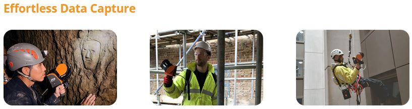
Effortless data capture
A handheld LiDAR scanner, suitable for drone mapping applications as well as indoor use. This powerful tool helps make the mapping process simple. With a range of 100m, the ZEB Horizon is great for outdoor use including spaces where features are positioned further apart.
Lightweight and rugged, ZEB HORIZON is simple to use, fast to capture and easy to process, so you have the most accurate information you need to make the most important decisions. With powerful SLAM technology at its heart, the ZEB HORIZON can even be used in remote areas with poor GPS – such as underground or in forest environments.
Go further than ever before with ZEB HORIZON’s range of mounting options, including UAV compatibility. With a collection rate of 300,000 points per second, and an accurate of 1-3cm, the ZEB HORIZON is suitable for a vast array of applications.
Speed: With 300,000 scanner points per second, it’s fast work scanning both simple and complex environments. You can carry out high-quality scans in less time
Portability: Light weight and portable, you can move freely whilst using this device. This portable 3D scanner features a rotating LiDAR sensor for the widest field of view. Its compact size and ergonomic design make it a delight to use
Accuracy: The ZEB Horizon provides 3D scanning with a survey grade relative accuracy of up to 6mm dependant on the environment. This gives you accurate scans and fine details
Versatility: With a range of 100m, the ZEB Horizon is our most flexible 3D laser scanner yet. Use it outdoors, indoors or underground. Mount it to a drone, a backpack or a vehicle.
The ZEB Horizon Now available in real-time
Our most flexible scanner now available with real-time data previews. The ZEB Horizon RT allows you to track your progress as you scan. It is the ideal, easy-to-use tool to gain real-time insight into your scans and to see your point cloud being created as you walk.
Your tool to capture, process and understand the world around you
With powerful SLAM technology at its heart (we call it GeoSLAM Beam), the ZEB Horizon can be used in areas with poor GPS – such as indoors, underground or outdoors.
Ultimate Flexibility in One Device
One ZEB Horizon, unlimited ways to use it. Move between accessories in minutes.
 |
LiDAR and high resolution imagery from the ZEB Discovery with ultra-high definition imagery from the NCTech iStar Pulsar camera |
 |
Connect your point cloud to the real world, without the need for external control points with the ZEB Locate |
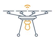 |
Mount the ZEB Horizon to a UAV and take to the skies for complete coverage of all features |
 |
Use the ZEB Pano for adding 360° panoramic photography to your point clouds (also available for ZEB Revo RT) |
 |
Car mounted data collection for urban road layouts, features and signage. |
 |
Pole and cradle for deploying underground or places that are hard to reach |
Related Product of the Used Geoslam ZEB HORIZON 3D UAV mount
-
Used Artec Eva 3D Scanner
$5,000
-
Used FARO Focus3D 120
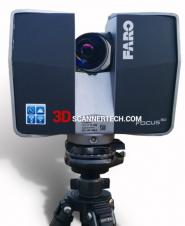
$7,500
-
Used Trimble TX5 3D Scanner
$8,500